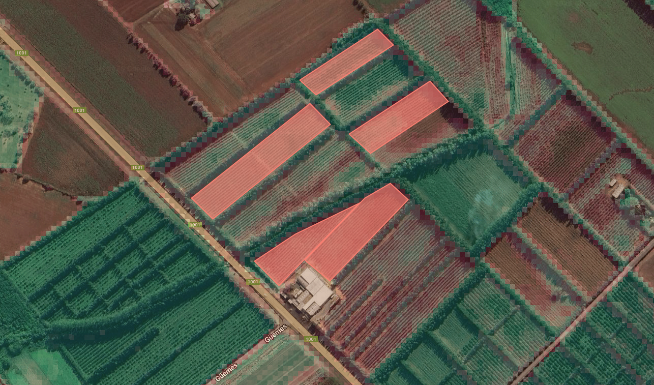
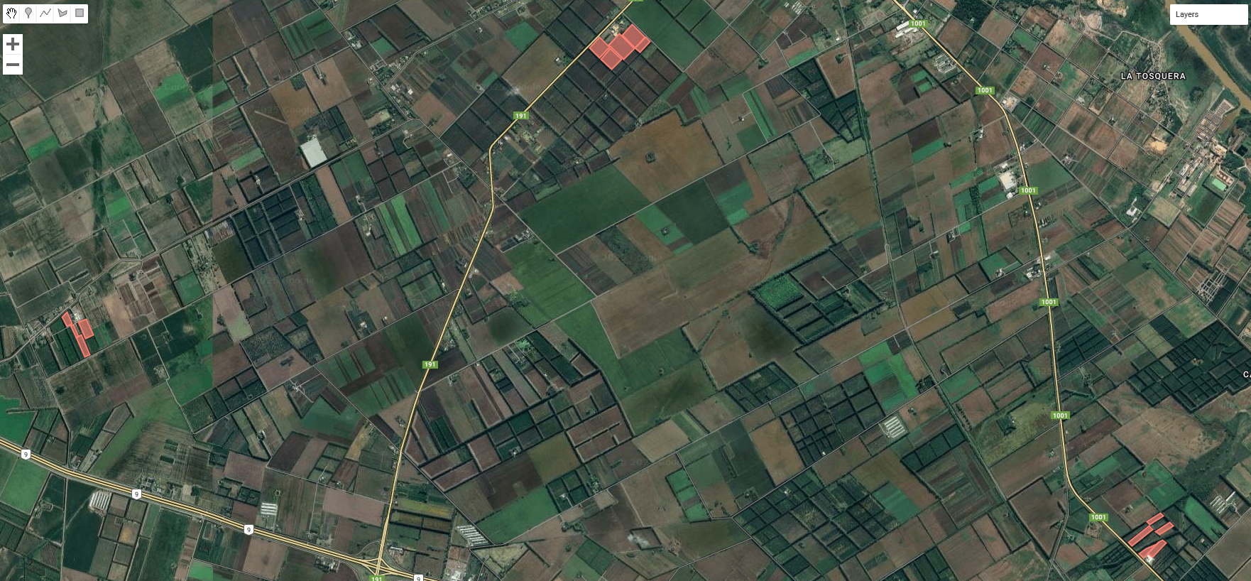
Fruit orchard monitoring through satellite imagery
This project focuses on the collection of satellite images to extract vegetation indices for the construction of a dataset aimed at predicting flowering dates. The pipeline includes remote sensing data acquisition, feature engineering, and the implementation of tree-based machine learning models such as Random Forest and XGBoost for regression tasks.
Stack: Sentinel-2 QGIS Python XGBoost Scikit-learn

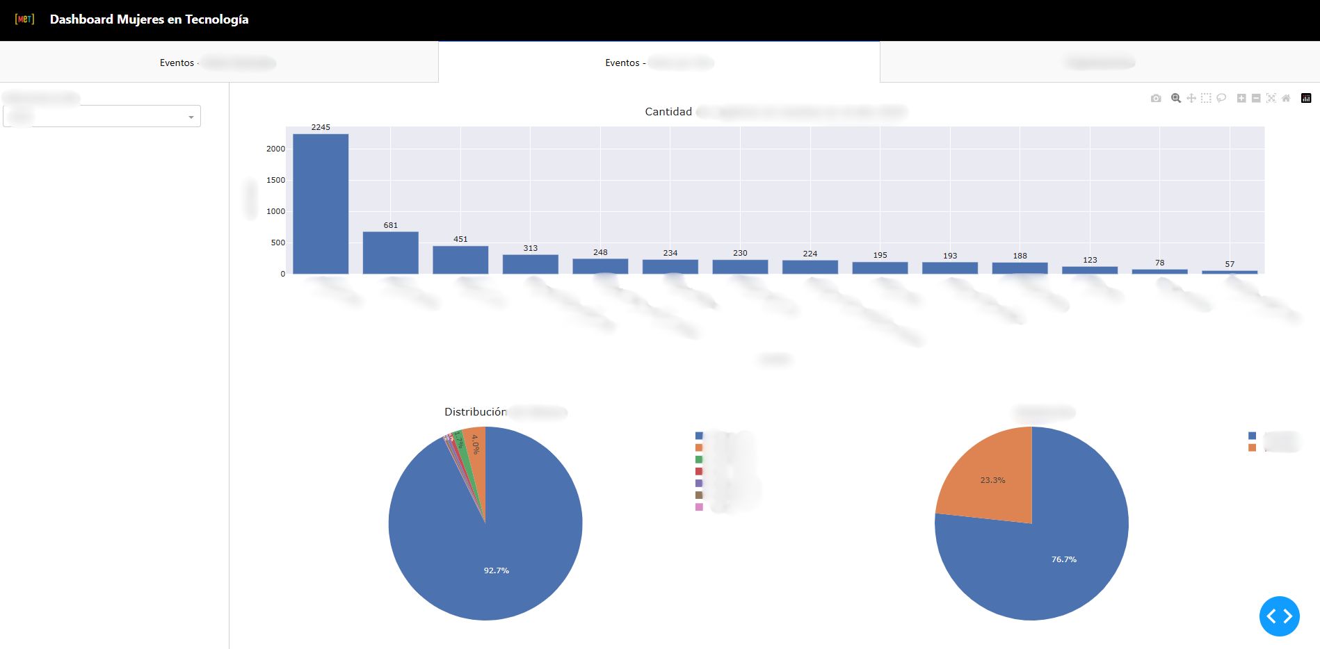
Dashboard Mujeres en Tecnología
Dashboard built by validating and cleaning non-relational data, implementing exploratory queries, and uncovering key insights.
Stack: Python Pandas Numpy Dash Plotly
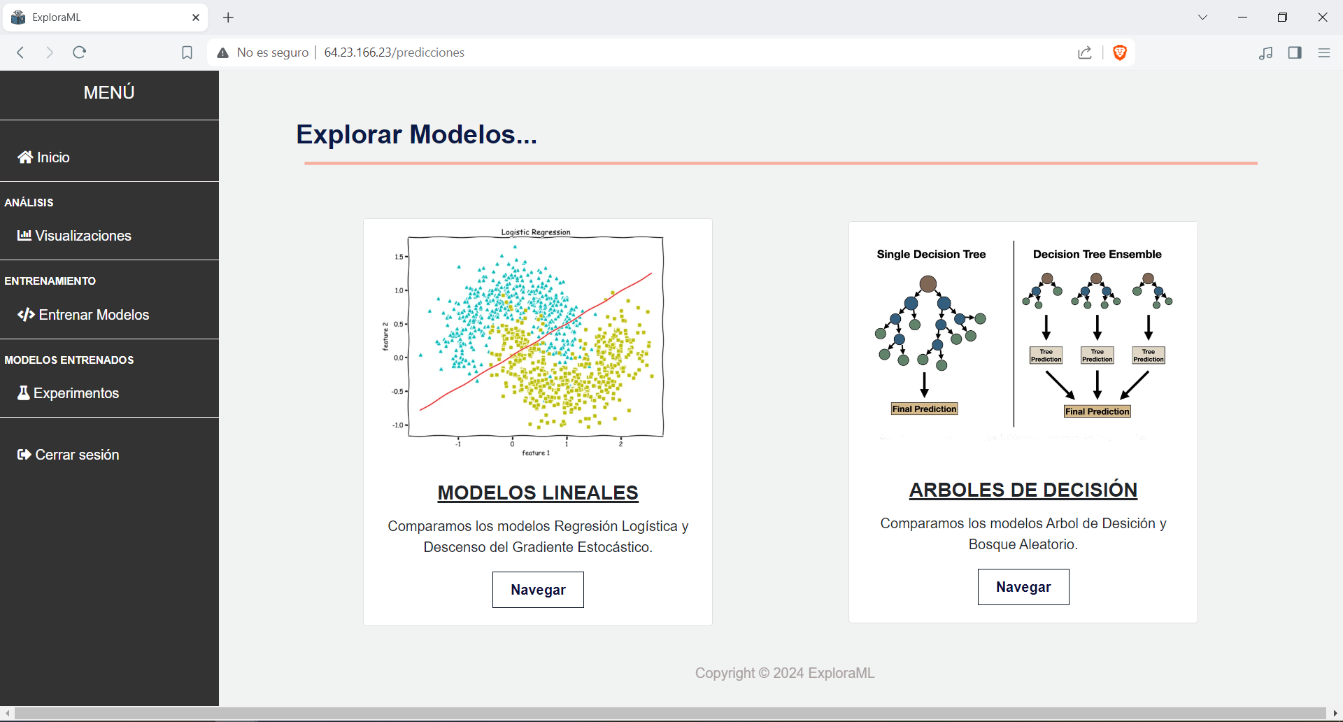
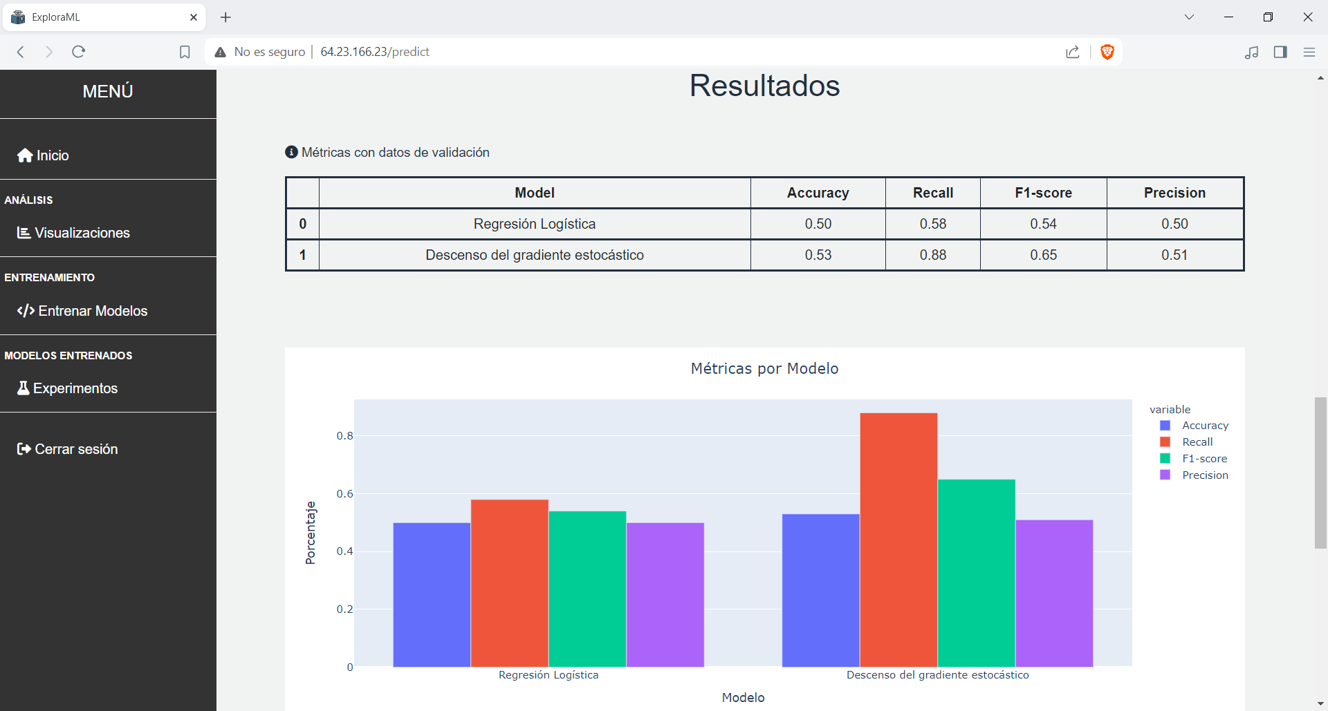
ExploraML
ExploraML is my degree thesis. It is a web platform designed to introduce basic machine learning concepts, allowing users to interact with a churn prediction dataset and run different supervised learning techniques such as Logistic Regression, Stochastic Gradient Descent, Random Forest, Decision tree and compare their performance.
🔗View on githubStack: Python Pandas Numpy Plotly Scikit-learn Flask SQLite Gunicorn
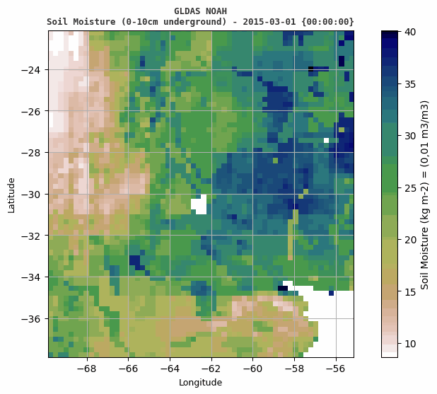
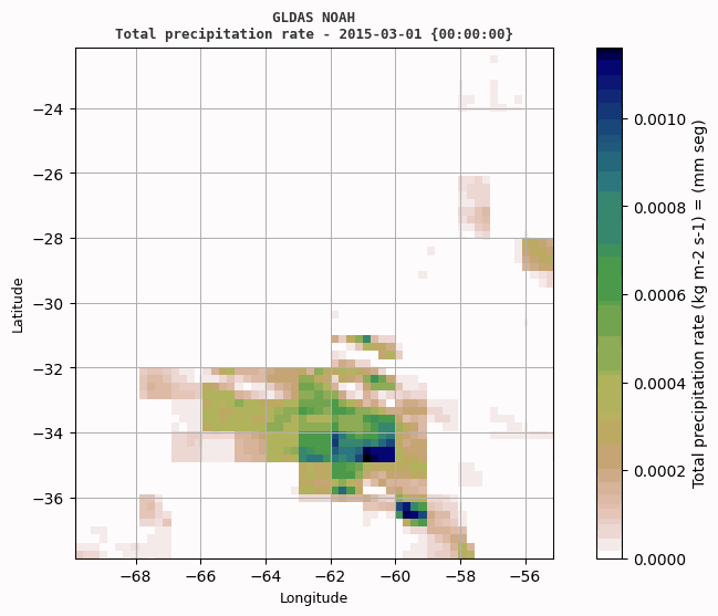
Soil Moisture Prediction
Visualizations built from satellite data collected from the Global Land Data Assimilation System (GLDAS).
🔗View on githubStack: Python Numpy netCDF4 Matplotlib PIL